VisioPlan Google Viewer: Seamlessly Embedding 3D Models into Real-World Environments
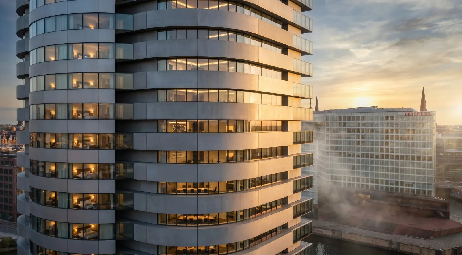
The ultimate challenge in architectural visualization has always been capturing context. A design never exists in a vacuum; it constantly interacts with neighboring buildings, existing topography, and localized lighting conditions. Traditionally, embedding a 3D model into its real-world environment meant either hunting for matching drone footage or painstakingly reconstructing the entire neighborhood by hand.
With the latest feature update to the VisioPlan platform, this tedious workflow is a thing of the past. The new Google Viewer bridges the gap between precise BIM/3D modeling and high-fidelity, real-world 3D environmental data. Architects can now seamlessly locate, modify, and transform their designs within a three-dimensional map of the actual urban fabric, leveraging generative AI to deliver photorealistic masterpieces. That gap between planning data and finished image is exactly what our article on the “missing middle” of AI in architecture describes.
Disclosure: This article comes from the team behind VisioPlan and describes a feature of our own product - feature status and research as of: May 2026.
I. The Google Viewer: Revolutionizing Urban Context
The Google Viewer within VisioPlan is far more than a basic satellite map. It is an interactive, real-time 3D environment powered by high-resolution geospatial data.
Why Context Dictates Success in 2026
Clients, competition juries, and planning authorities now demand absolute transparency. An isolated rendering against a white backdrop or a generic row of digital trees no longer suffices. The industry now demands a visual answer to a critical question: How does this building interact with the existing built fabric? The Google Viewer answers this instantly by fusing your custom 3D model with real-world photogrammetric data.
II. Step-by-Step Guide: From Import to Final Contextual Rendering
The workflow within the VisioPlan Google Viewer is designed around an intuitive, structured user experience. The process demonstrates how seamlessly an architectural asset can be integrated into a real-world environment—such as a riverfront site in Hamburg—in just a few steps. How that differs from the common screenshot-and-prompt method is walked through in our step-by-step comparison of both routes.
Step 1: Enter the Address and Locate the Site
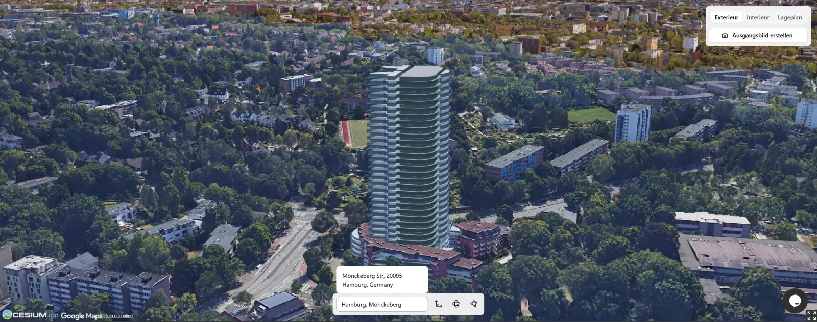
The workflow begins directly in the VisioPlan dashboard. Using the integrated search bar, type in the exact address of the project—in this scenario, Obergeorgswerder Hauptdeich in Hamburg. The viewport instantly flies to the target coordinates, streaming a highly detailed 3D environment complete with native vegetation, roads, and surrounding architecture.
Step 2: Align the Model with Precision
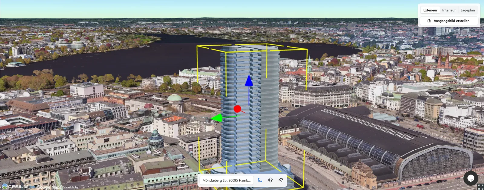
Once your 3D model is placed onto the site, dynamic 3D transform gizmos are activated. These tools allow you to shift, rotate, and elevate the building along the X, Y, and Z axes with millimeter precision until it sits flawlessly on the digital plot.
Step 3: Clip the Existing Context (Clipping Polygons)
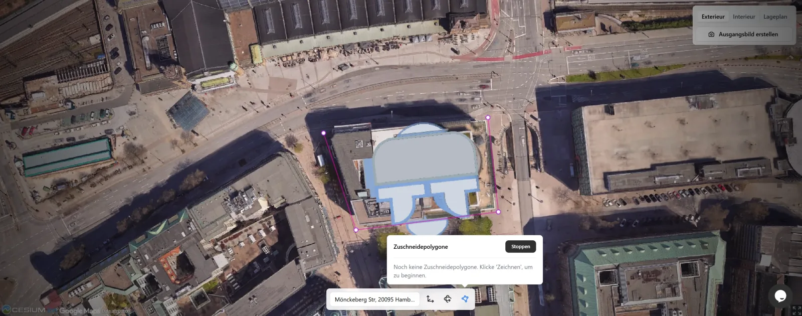
A common issue with raw 3D map data is that existing trees or legacy structures often clip through the new design. VisioPlan solves this elegantly with its "Clip Context" tool. By drawing a flexible clipping polygon, the planner can trace the boundaries of the new structure. The conflicting elements of the Google Maps geometry are then cleanly hidden within that specified zone.
Step 4: Generate the Base Image and Define the Scene
Once the perfect camera perspective is locked in, clicking a button captures the base image. This opens up the core AI control panel, where you can configure the entire atmospheric identity of the scene:
- Image Style & Resolution: Toggle between HD and UHD quality, and choose from various photorealistic rendering engines.
- Time of Day & Season: Select Golden Hour (Morning), Blue Hour (Evening), or crisp midday sun—the system automatically maps the lighting characteristics to your chosen season (Spring, Summer, Autumn, Winter).
- Environment & Weather: Define the overall context (e.g., Pure Nature & Park) and specific weather parameters (Mist, Rain, Sunny).
- Semantic Prompts (Additional Details): Input specific material descriptions, such as "The facade features light-toned, board-formed concrete..." to guide the asset's materiality. Our guide to AI architectural rendering shows how such material descriptions should be built.
III. Enjoying the Result: The Before-and-After Comparison
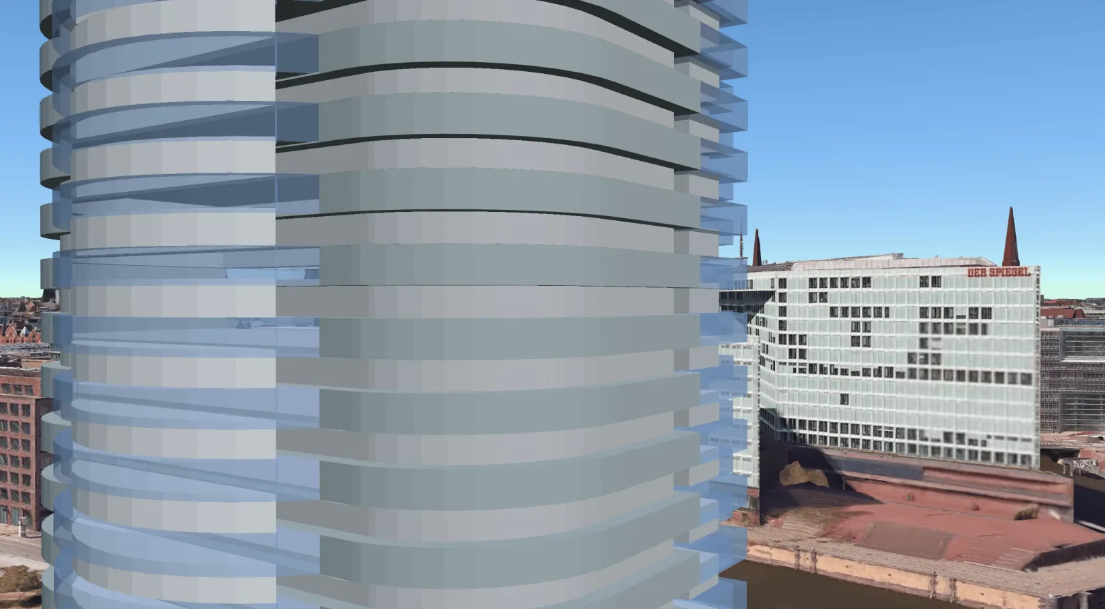
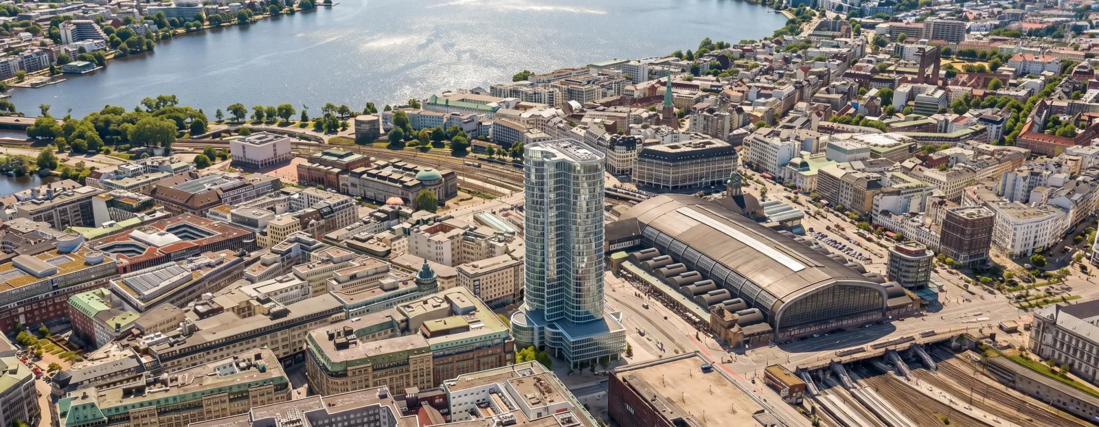
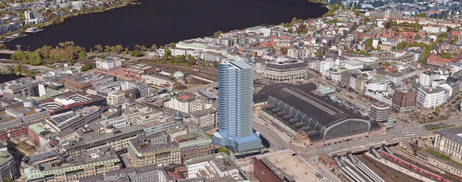
Following a brief analysis and cloud-rendering phase, VisioPlan reveals the final output. An interactive slider in the user interface lets you swipe smoothly between the raw 3D map data and the final AI-generated architectural rendering.
The generative model performs exceptionally well here: it translates the coarse geometries of the contextual map into a vibrant, photorealistic landscape. The river accurately reflects the sunlight, the surrounding foliage gains organic depth, and the imported building is anchored into the Hamburg riverfront with physically accurate shadows and textures.
IV. Pros and Cons of the Google Viewer at a Glance
Integrating real-world 3D environmental data fundamentally shifts the dynamics of architectural communication. However, like any advanced tool, it should be deployed strategically. How this approach compares with the established real-time renderers is covered in our 2026 ROI ranking.
| Advantages of the Google Viewer | Practical Considerations & Limitations |
|---|---|
| Massive Time Savings: Eliminates the need for manual contextual modeling or complex Photoshop compositing. | Data Availability: The fidelity of the 3D surroundings depends entirely on locally available Google photogrammetry data. |
| Flawless Lighting Consistency: The AI blends the model and its surroundings into a completely homogeneous atmospheric composition. | Regulatory Precision: Designed primarily for atmospheric and urban-scale visualization, not for official property line surveys. |
| Real-Time Iterations: Modifying sun positions, seasons, or weather conditions takes only seconds. | Degree of Abstraction: For ultra-early conceptual phases, the high realism of the environment can sometimes feel too definitive. |
V. Conclusion: Context-Driven Design as the New Standard
With the launch of the Google Viewer, VisioPlan proves that high-end architectural rendering in 2026 is no longer gated by massive visualization budgets or multi-week production timelines. Fusing real-world geospatial datasets with generative AI grants architects the agency to showcase designs exactly as they will manifest in reality from day one. What the different routes to a visualization actually cost is set out in our full-cost calculation for 2026.
The Google Viewer removes the disjointed look typical of isolated digital assets, setting a new benchmark for contextual presentation. The era of visualizing a building completely detached from its physical destiny is officially over.
Frequently asked questions about the Google Viewer
What data do I need to work with the Google Viewer?
A 3D model and an address. The model reaches the browser as an IFC file or through a CAD connection; the surroundings come from the 3D geodata of the site itself.
How accurate is the contextual geometry?
It depends on the photogrammetry data available locally. In densely built cities the level of detail is high, in rural locations considerably lower. It is sufficient for atmospheric and urban-scale presentation; it is not intended for checking boundary distances.
What happens to trees or existing buildings that intersect the new design?
They are removed from the site with a clipping polygon. The planner traces the outline of the new building, and the conflicting map geometry is hidden within that area.
Is the viewer suitable for very early design phases?
Only with reservations. In the earliest phases the realism of the surroundings implies a decision that has not been made yet. For competitions, planning applications and marketing, that same realism is the whole point.
Does this replace rebuilding the neighbourhood by hand?
For presentation and sales imagery, generally yes. What disappears is the hunt for suitable drone footage and the manual modelling of the existing context.